
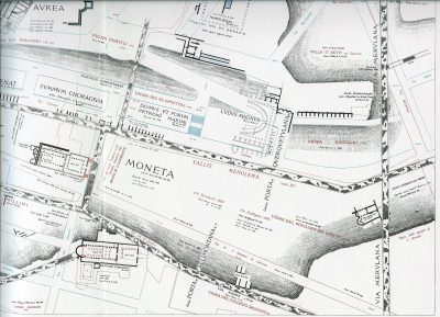
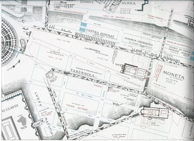
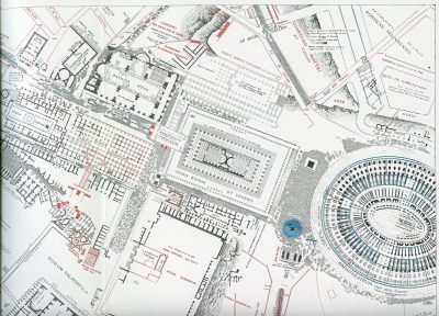
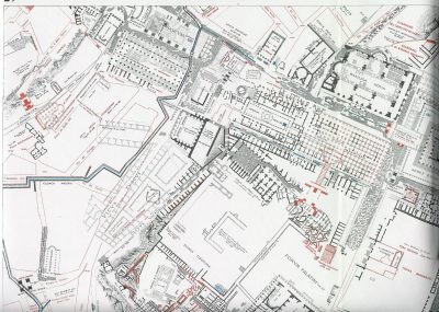
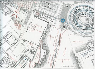
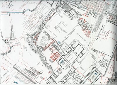
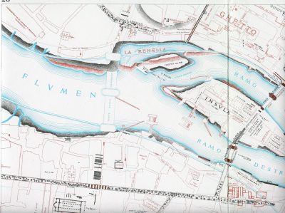
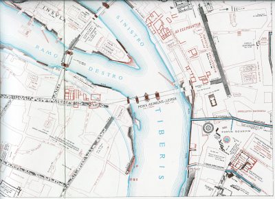
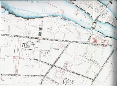
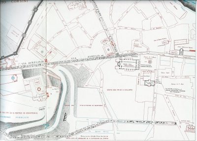
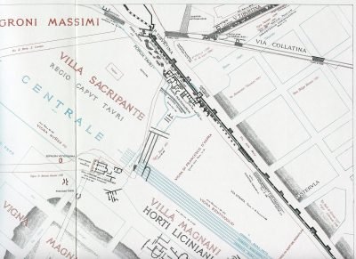
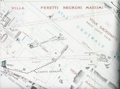
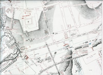
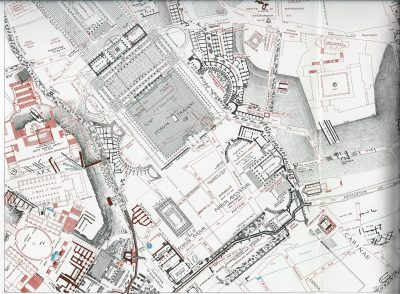
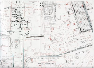
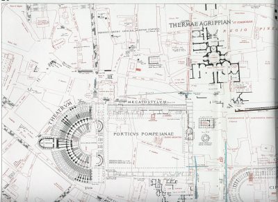
The Forma Urbis Romae by Rodolfo Lanciani is a detailed map of all the ancient ruins in Rome as of 1893-1901 when it was first published. The “Forma Urbis Romae” consists of 46 separate plates covering most of the central parts of Rome.

Rodolfo Lanciani was in charge of most of the excavations in Rome in the last decades of the 19th century and was the leading authority of his time on the archaeology of ancient Rome.
Obviously several parts of the maps are dated and no longer considered correct, but other parts retain their value and some parts show ruins no longer visible in to the normal visitor in Rome.
The maps are colour coded. The ancient parts are in black, the modern parts in red and the parts delineated in thin blue lines are planned changes. Much of what the modern visitor takes for granted in Rome was just on the drawing board or not even thought of in 1901.
Major parts of the 46 plates are present here, but not all the plates in their entirety. The list below gives the title given to each plate by Lanciani and the parts present here. Due to the size of the pages, many pages are scanned in four parts, denominated “lower left”, “lower right”, “upper left”, “upper right”. Otherwise the name of the monument is given.
- Plate I – Piazza del Popolo
- Plate II – Villa Borghese
- Plate III – Porta Salaria
- Plate IV – Via Nomentana
- Plate V – Valle D’Inferno
- Plate VI – Giardino Vaticano (north)
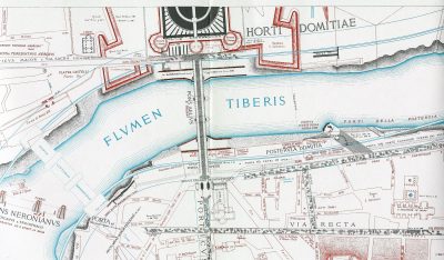
detail: Vatican Museums - Plate VII – Campus Neroniana
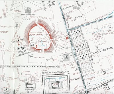
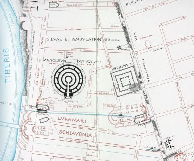
detail: Hadrian’s Mausoleum (part) - Plate VIII – Campus Martius (north)
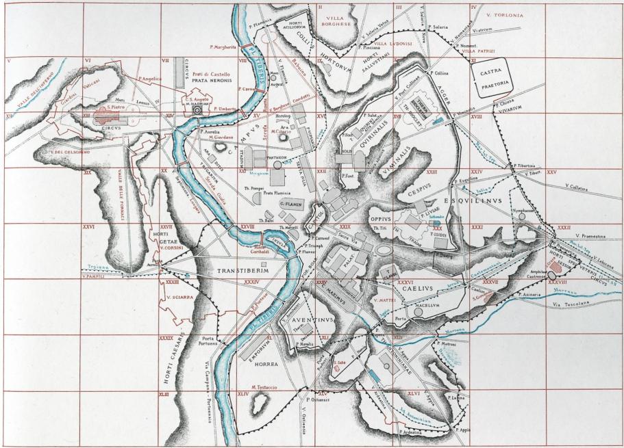
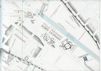
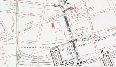
details: Augustus’ Mausoleum, Ara Pacis (part) - Plate IX – Horti Sallustiani
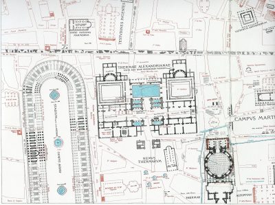
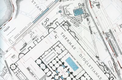
- Plate X – Terme Diocletianae
detail: Baths of Diocletian (part) - Plate XI – Castro Preatorio
- Plate XII – Giardino Vaticano (west)
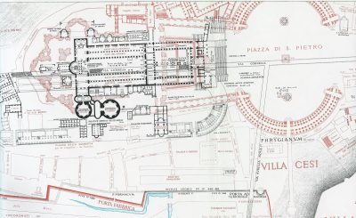
- Plate XIII – San Pietro (south)
detail: Saint Peters - Plate XIV – Pons Neronianus
detail: Hadrian’s Mausoleum (part) - Plate XV – Pantheon
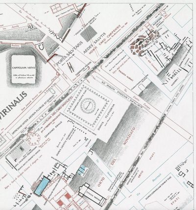
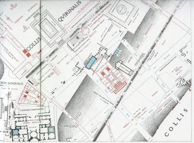
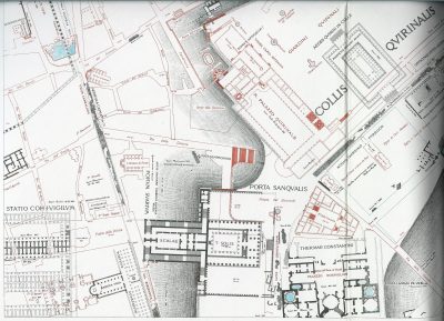
almost everything: lower left, lower right, upper right - Plate XVI – Quirinalis
almost everything: lower left, lower right, upper right - Plate XVII – Viminalis
detail: Baths of Diocletian (part) - Plate XVIII – Le Mura
- Plate XIX – Valle dei Fornaci
- Plate XX – Lungaretta
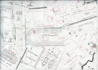
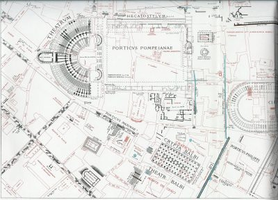
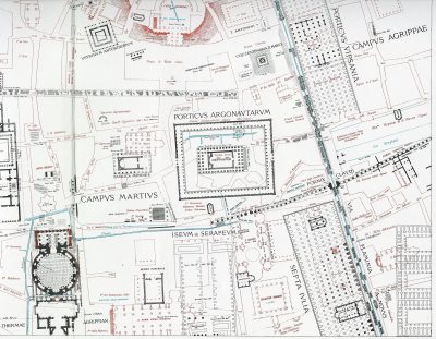
detail: Villa of Agrippa - Plate XXI – Thermae Agrippae
everything: lower left, lower right, upper left, upper right - Plate XXII – Fori Imperiali
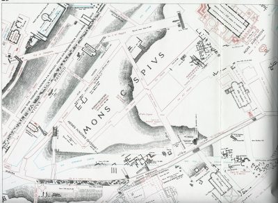
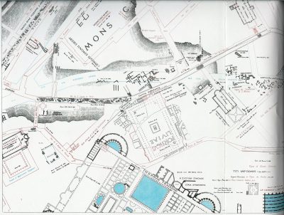
everything: lower left, lower right, upper left, upper right - Plate XXIII – Cispius
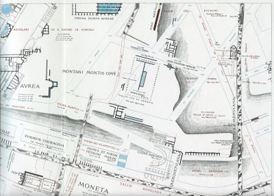
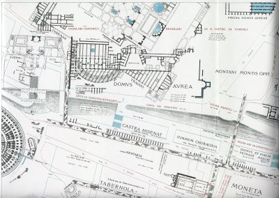
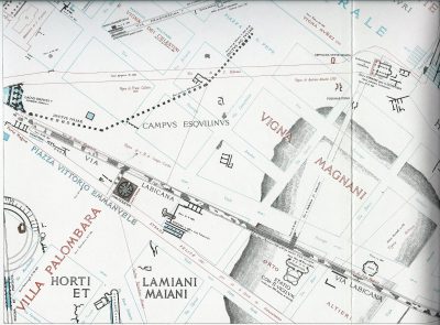
everything: lower left, lower right, upper left, upper right - Plate XXIV – Esquilinus
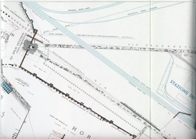
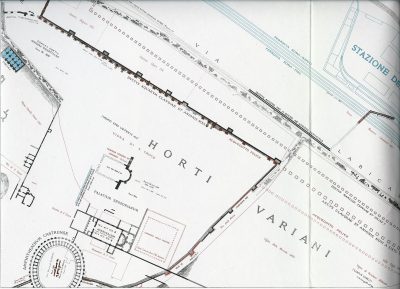
everything: lower left, lower right, upper left, upper right - Plate XXV – Via Collatina
- Plate XXVI – Via Aurelia
- Plate XXVII – Ianiculum
detail: Trastevere - Plate XXVIII – Isola Tiberina
everything: lower left, lower right, upper left, upper right - Plate XXIX – Forum Romanum
everything: lower left, lower right, upper left, upper right - Plate XXX – Thermae Traiani
everything: lower left, lower right, upper left, upper right - Plate XXXI – Aqua Marcia
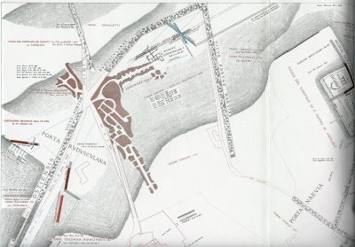
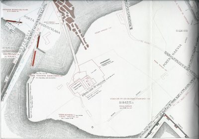
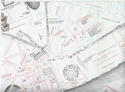
- Plate XXXII – Porta Maggiore
details: lower left, upper right - Plate XXXIII – Villa Sciarra
details: lower right, upper right - Plate XXXIV – Transtiberim (south)
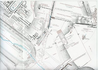
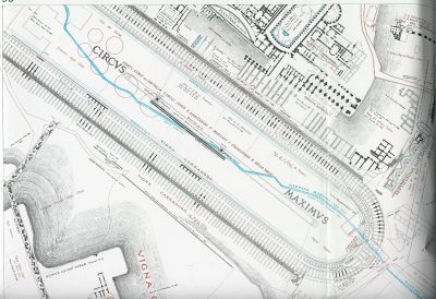
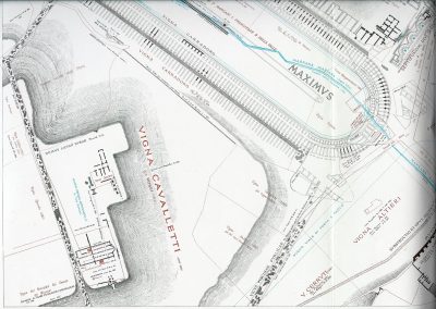
- Plate XXXV – Circus Maximus
everything: lower left, lower right, upper left, upper right - Plate XXXVI – Caelius
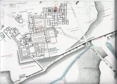
detail: upper left - Plate XXXVII – Porta Asinaria
detail: The Lateran - Plate XXXVIII – Acqua Marrana
- Plate XXXIX – Porta Portuensis
- Plate XL – Marmorata
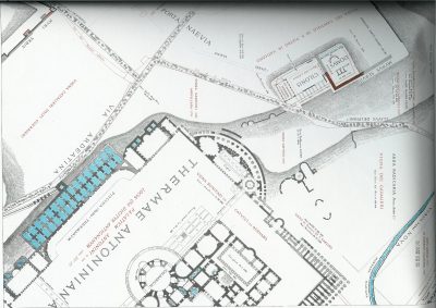
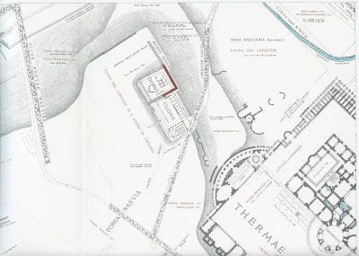
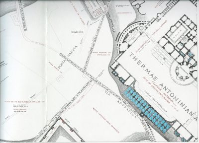
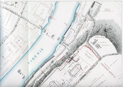
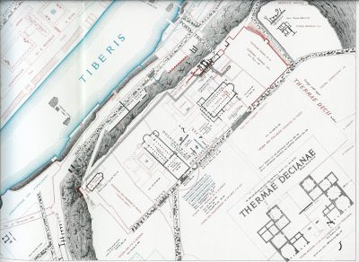
- Plate XLI – Thermae Antonianae
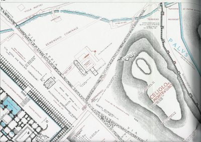
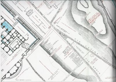
everything: lower left, lower right, upper left, upper right, Thermae Antonianae - Plate XLII – Porta Metronia
details: lower left, upper left (Thermae Antonianae) - Plate XLIII – Via Publica Campana
- Plate XLIV – Testaccio
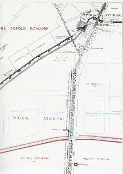
detail: Porta Ostiense and Pyramid - Plate XLV – Porta Ostiensis
- Plate XLVI – Porta San Sebastiano
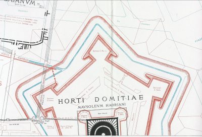
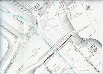
detail: Via Appia
Links
- LacusCurtius: Lanciani Online
- Aquae Urbis Romae (wayback machine) (has all 46 pages online, but in low resolution).
Photo gallery for "Lanciani: Forma Urbis Romae"
There are 64 photos in this gallery.
-
15-UR-ara-pacis -
07-BC-hadrian2 -
46-via-appia -
44-porta-ostiense -
42-UL-thermae-antoniane -
42-LL-thermae-antoniane -
41-thermae-antoniane -
41-UR-thermae-antoniane -
41-UL -
41-LR-thermae-antoniane -
41-LL -
37-lateran -
36-UL -
35-UR-circus-maximus -
35-UL-circus-maximus -
35-LR-circus-maximus -
35-LL-circus-maximus -
34-UR-aventine -
34-LR-aventine -
32-UR-porta-praenestina -
32-LL-sessorianum -
30-UR-merulana -
30-UL-colosseum -
30-LR-clemente -
30-LL-colosseum -
29-UR-colosseum -
29-UL-palatin -
29-LR-colosseum -
29-LL-palatin -

28-UR-tiberina -
28-UL-tiberina -
28-LR-tiberina -
28-LL-tiberina -
27-LR-trastevere -
24-UR-stazione -
24-UL-stazione -
24-LR-stazione -
24-LL-labicana -
23-UR-esquilinus -
23-UL-thermae-traiane -
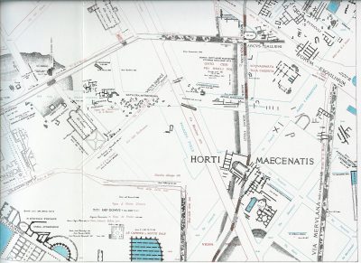
23-LR-maecenatis -
23-LL-thermae-traiane -
22-UR-fori-imperiali -
22-UL-fori-imperiali -
22-LR-fori-imperiali -
22-LL-fori-imperiali -
21-UR-septa -
21-UL-poimpeius -
21-LR-porticus-octaviae -
21-LL-pompeius -
20-LR-villa-agrippa -
17-UC-thermae-diocletiani -
16-UR-quirinalis -
16-LR-quirinalis -
16-LL-quirinalis -
15-LR-campus-martius -
15-LL-campus-martius -
14-UC-hadrian -
13-UC-san-pietro -
10-BC-thermae-diocletiani -
08-LR-ara-pacis -
08-CC-mausoleum-aug -
06-CL-vatican-museum -
00-fur
Stavros Macrakis says:
The links in the text section above are incorrect.
For example, “Pantheon Lower Left” should presumably link to
https://sights.seindal.dk/other-images-sources/lanciani-forma-urbis-romae/15-ll-campus-martius/, but in fact it links to https://sights.seindal.dk/photo/9920, which does not exist.
6 June 2020 — 20:27
René Seindal says:
Thanks a million for your comment.
The links should work now. I had made a mistake in the migration of the old site to WordPress.
28 June 2020 — 22:14
francesca Ambroselli says:
Ma a che epoca si riferiscono le mappe di Lanciani? Età romana imperiale o repubblicana?
21 June 2022 — 19:31
Dale Wunderlich says:
I have now solved a mystery that has bugged me for 24 years… where does the drain lead to, from the center of the pantheon? Well, because you have shared these good resolution maps, I now know.
Thank You!
1 December 2022 — 02:56